Published on: May 11, 2023
Written by Shaown Khan / Fact-checked by Kader Khan
Thunderstorms have captured our imagination and fascination for centuries. With their brilliant flashes of lightning and booming peals of thunder, they showcase nature’s raw power and beauty. Despite their intimidating presence, thunderstorms play a vital role in the Earth’s water cycle and help regulate our planet’s temperature.
Overview of a Thunderstorm’s Life Cycle
A thunderstorm’s life cycle consists of three main stages: development, maturity, and dissipation. Throughout this article, we’ll explore the science behind these atmospheric wonders, from their formation and classification to the various phenomena they produce. We’ll also discuss strategies for predicting and tracking thunderstorms to keep you informed and safe.
Formation of Thunderstorms
Necessary ingredients for a thunderstorm
For a thunderstorm to form, three essential ingredients must be present: moisture, instability, and a lifting mechanism.
Moisture
Moisture is necessary for the development of clouds and precipitation. It typically originates from bodies of water, like oceans and lakes, and is transported into the atmosphere through evaporation and transpiration from plants.
Instability
Atmospheric instability occurs when a parcel of air becomes buoyant, meaning it rises because it’s warmer and less dense than the surrounding air. When this happens, the rising air can create towering cumulonimbus clouds, the hallmark of a thunderstorm.
Lifting mechanism
A lifting mechanism is required to initiate the upward movement of air. This can be caused by various factors, such as the convergence of air at the surface, the presence of a frontal boundary, or terrain-induced lifting (orographic lift).
Role of atmospheric instability
Atmospheric instability is the driving force behind thunderstorm formation. In an unstable environment, air parcels can rise freely and rapidly, allowing for the growth of towering clouds and the development of thunderstorms.
The importance of wind shear
Wind shear – the change in wind speed and/or direction with height – can play a crucial role in thunderstorm development. Vertical wind shear can help organize storms and promote the formation of more severe thunderstorms, including supercells.
Types of lifting mechanisms
The most common lifting mechanisms include convergence, orographic lift, and frontal lift.
Convergence
Convergence occurs when air flows collide, forcing air to rise. This can result from the interaction of air masses with different temperatures or from localized heating, such as urban heat islands.
Orographic lift
Orographic lift happens when air is forced to rise due to terrain, such as mountains or hills. As the air rises, it cools, potentially leading to cloud formation and thunderstorm development.
Frontal lift
Frontal lift occurs when a cold air mass pushes beneath a warmer air mass, forcing the warm air to rise. This process can create a line of thunderstorms along a frontal boundary.
Types of Thunderstorms
Single-cell thunderstorms
Single-cell thunderstorms are small, isolated storms that typically last for 30 minutes to an hour. They form in environments with weak wind shear and often develop in the late afternoon and early evening when surface heating is at its peak.
Life cycle
Single-cell thunderstorms progress through the typical stages of development, maturity, and dissipation, with the storm reaching its peak intensity during the maturity stage.
Hazards
Though generally short-lived and less severe than other types of thunderstorms, single-cell storms can still produce heavy rain, lightning, small hail, and gusty winds.

Multi-cell thunderstorms
Multi-cell thunderstorms consist of multiple individual storm cells, with new cells continuously developing as older cells dissipate. These storms can last for several hours and are often associated with more severe weather than single-cell thunderstorms.
Life cycle
Multi-cell thunderstorms form when a triggering mechanism, like a cold front, causes multiple updrafts to develop. As older cells dissipate, new cells form and continue the cycle, allowing the storm system to persist for an extended period.
Hazards
These storms can produce heavy rain, frequent lightning, large hail, strong winds, and occasionally tornadoes. The severity of multi-cell storms can vary greatly, with some producing only moderate rainfall and others causing widespread damage.
Supercell thunderstorms
Supercell thunderstorms are the most powerful and well-organized of all thunderstorm types. They form in environments with strong wind shear and can last for several hours, producing intense weather phenomena.
Life cycle
Supercell thunderstorms are characterized by a persistent rotating updraft called a mesocyclone. This rotation helps organize the storm and maintain its intensity over a longer period compared to other thunderstorm types.
Hazards
Supercells are responsible for the most violent tornadoes, large hail, damaging straight-line winds, and flash flooding. They pose a significant threat to life and property and require close monitoring by meteorologists and storm spotters.
Mesoscale Convective Systems (MCS)
An MCS is a large, organized cluster of thunderstorms that can cover hundreds of miles and last for many hours or even days. These systems often form along frontal boundaries or in environments with abundant moisture and instability.
Life cycle
MCSs can evolve from single or multi-cell thunderstorms and typically develop during the afternoon and evening, often persisting through the night. They can produce widespread rainfall, leading to significant flooding events.
Hazards
MCSs can produce a wide range of hazards, including heavy rain, flash flooding, damaging winds, large hail, and tornadoes. Due to their size and duration, they can have substantial impacts on communities and infrastructure.
Thunderstorm Phenomena
Lightning
Lightning is the result of the buildup and discharge of electrical energy within a thunderstorm. It can strike the ground, other parts of the cloud, or even other clouds.
Formation process
As a thunderstorm develops, collisions between ice particles in the cloud create an electrical charge separation, with positively charged particles rising to the top of the cloud and negatively charged particles sinking to the bottom. When the charge difference becomes too great, a lightning discharge occurs.

Types of lightning
There are several types of lightning, including cloud-to-ground, intracloud, and cloud-to-cloud lightning. Cloud-to-ground lightning poses the most significant risk to humans and infrastructure.
Lightning safety tips
To stay safe during a thunderstorm, follow the 30-30 rule: if the time between a lightning flash and the sound of thunder is 30 seconds or less, seek shelter immediately. Remain indoors for at least 30 minutes after the last thunder is heard.
Thunder
Thunder is the sound produced by the rapid expansion and contraction of air heated by a lightning strike. The heated air can reach temperatures up to five times hotter than the surface of the sun, causing it to expand rapidly and create a shockwave that we hear as thunder.
How thunder is created
When lightning strikes, the air around the lightning channel heats up and expands rapidly, creating a shockwave that moves through the atmosphere. As the shockwave travels away from the lightning channel, it slows and becomes an audible sound wave, which we hear as thunder.
The science behind the sound
The distance between you and a lightning strike affects the sound of thunder. Close lightning strikes produce a sharp, cracking sound, while more distant strikes result in a low, rumbling noise.
Hail
Hailstones are solid ice particles that form in thunderstorms when strong updrafts carry raindrops upward into freezing layers of the atmosphere. The raindrops freeze and continue to grow as they collide with other supercooled water droplets, eventually falling to the ground when they become too heavy for the updraft to support.
Formation process
The hail formation process begins with a small ice nucleus that grows as it ascends and descends within the thunderstorm. The hailstone’s size depends on the strength of the updraft and the amount of time it spends in the storm.
Impact on infrastructure and agriculture
Large hailstones can cause significant damage to buildings, vehicles, and crops. In some cases, hailstorms have resulted in billions of dollars in losses and have devastated agricultural communities.
Hailstorm safety tips
To stay safe during a hailstorm, seek shelter indoors or in a sturdy vehicle. Keep away from windows, as hail can shatter glass and cause injuries.
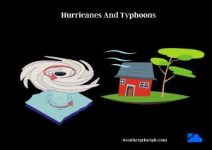
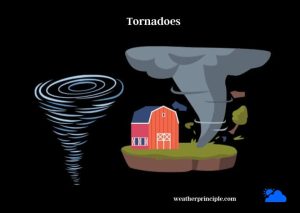
Tornadoes
Tornadoes are violent, rotating columns of air that extend from the base of a thunderstorm to the ground. While they can form in various types of thunderstorms, they are most commonly associated with supercell thunderstorms.
Formation within thunderstorms
Tornadoes form when strong updrafts in a thunderstorm interact with horizontal wind shear, causing the air to rotate. As this rotation tightens and intensifies, it can form a funnel cloud that eventually reaches the ground, becoming a tornado.
Tornado safety tips
To stay safe during a tornado, seek shelter in a small, windowless room on the lowest level of a sturdy building. If you are caught outdoors, find a low-lying area, such as a ditch, and cover your head and neck.
Downbursts and straight-line winds
Downbursts are powerful downdrafts within a thunderstorm that can cause damaging straight-line winds at the surface. These winds can reach speeds of over 100 mph and can cause widespread damage similar to that of a tornado.
Formation and characteristics
Downbursts form when rain-cooled air descends rapidly within a thunderstorm, impacting the ground and spreading out in all directions. They can be categorized as microbursts or macrobursts, depending on their size and duration.
Associated hazards and safety tips
Downbursts and straight-line winds can cause damage to buildings, uproot trees, and overturn vehicles. To stay safe, seek shelter indoors during a thunderstorm and stay away from windows.
Predicting and Tracking Thunderstorms
Meteorological tools for predicting thunderstorms
Meteorologists use a variety of tools and techniques to predict and track thunderstorms, including weather models, Doppler radar, and satellite imagery.
Weather models
Weather models are computer simulations that use complex mathematical equations to predict atmospheric conditions. These models can help meteorologists identify areas at risk for thunderstorm development.
Doppler radar
Doppler radar detects precipitation, wind speed, and direction within a thunderstorm. It can help meteorologists identify features such as rotation, hail, and heavy rainfall, which can indicate the potential for severe weather.
Satellite imagery
Satellite images provide a birds-eye view of cloud patterns, helping meteorologists track the movement and evolution of thunderstorms.
Importance of storm spotters and chasers
Storm spotters and chasers provide valuable ground truth observations of thunderstorms, often confirming the presence of tornadoes, hail, and strong winds. Their reports help meteorologists issue accurate and timely warnings to the public.
Thunderstorm watches and warnings
A thunderstorm watch means conditions are favorable for thunderstorm development, while a thunderstorm warning indicates a storm is imminent or occurring. Pay attention to watches and warnings issued by your local weather service to stay informed and prepared.
Summary
Recap of thunderstorm formation, types, and phenomena
In this article, we’ve explored the various aspects of thunderstorms, including their formation, classification, and the diverse phenomena they produce. We’ve discussed the importance of atmospheric instability, wind shear, and lifting mechanisms in the development of thunderstorms. We’ve also examined the differences between single-cell, multi-cell, supercell, and mesoscale convective systems, as well as the hazards each type can present.
Emphasis on public awareness and safety
Understanding the nature of thunderstorms and their potential hazards is crucial for public safety. By staying informed and following safety guidelines during thunderstorms, you can protect yourself, your loved ones, and your property. Always pay attention to watches and warnings issued by your local weather service and be prepared to take action when necessary.
Frequently Asked Questions (FAQs)
What is the difference between a thunderstorm watch and a thunderstorm warning?
A thunderstorm watch means that conditions are favorable for thunderstorms to develop, while a thunderstorm warning indicates that a storm is imminent or occurring. A warning requires immediate action to protect life and property, while a watch means you should stay alert and be prepared to take action if a warning is issued.
How can I protect myself and my property during a thunderstorm?
To protect yourself during a thunderstorm, seek shelter indoors or in a sturdy vehicle. Stay away from windows, as lightning and hail can shatter glass. Unplug electronics and avoid using corded phones to reduce the risk of electrical shock. If you are outdoors, find a low-lying area away from tall objects, such as trees or poles.
To protect your property, secure outdoor items that could be blown away by strong winds, park vehicles in a garage or under a carport, and trim dead or weak branches from trees near your home.
Are all thunderstorms severe?
Not all thunderstorms are severe. Severe thunderstorms are defined by the presence of one or more of the following: hail one inch in diameter or larger, wind gusts of 58 mph or greater, or tornadoes. Non-severe thunderstorms can still produce heavy rain, lightning, and gusty winds, but they typically do not pose the same level of threat to life and property as severe thunderstorms.
How can I receive timely thunderstorm alerts?
To receive timely thunderstorm alerts, consider signing up for emergency notification services provided by your local government or downloading a reliable weather app. Ensure that your smartphone is set to receive Wireless Emergency Alerts (WEA) issued by the National Weather Service. You can also purchase a weather radio to stay informed during severe weather events.
What are the most common misconceptions about thunderstorms?
Some common misconceptions about thunderstorms include:
- Lightning never strikes the same place twice: Lightning can and does strike the same place multiple times, especially tall objects like skyscrapers and radio towers.
- If it’s not raining, there’s no danger from lightning: Lightning can strike up to 10 miles away from a thunderstorm, even if it’s not raining at your location.
- Rubber tires on a car protect you from lightning: It’s the metal frame of the car that protects you by conducting the lightning around you, not the rubber tires.